
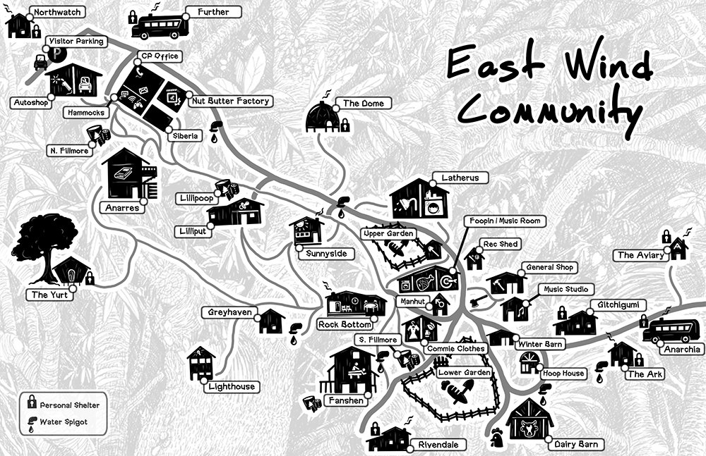
Map of Our Land
East Wind is located in the Heart of the beautiful Ozarks (rural Southern Missouri). Our Land encompasses nearly 1,200 acres. Over 800 acres of our Land has been set aside as a type of nature preserve (you might call it “The Woods”), and the remaining 345 acres hold our infrastructure and pastures. Crystal clear Lick Creek flows through and around the property before draining into Norfork Lake. Numerous walking and hiking trails and a few dirt roads run through the Community proper. The wilderness found here is beautiful, lush, and biodiverse. Glades and ravines, caves and jumping cliffs, swimming holes and rock beaches, and a wide variety of plant, tree, and animal life provide endless adventure for those with a love of nature.
The forest is home to a wide range of trees including varieties of black and white oak, hickories, black walnut, red cedar, yellow pine, dogwood, ash, mulberry, hackberry, persimmon, and sassafras, among others (including the Missouri State Champion Blackgum tree). Some wild edible and medicinal plants easily found here include chickweed, cleavers, dandelion, passionflower, chicory, chives, mullein, nettles, burdock, self-heal, plantain, and yarrow, among many others. The woods are teeming with an abundance of animal life including deer, squirrels, coyotes, armadillos, raccoons, groundhogs, skunks, snakes, lizards, frogs, turtles, etc. The skies are populated with blue jays, cardinals, black vultures and turkey vultures, owls, turkeys, and the occasional bald eagle, etc. The creek is home to many forms of aquatic life including crawdads, carp, trout, gar, bass, blue gill, and many more.
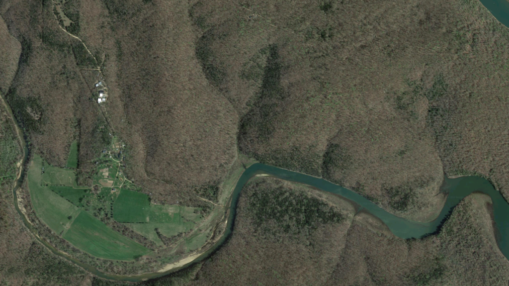
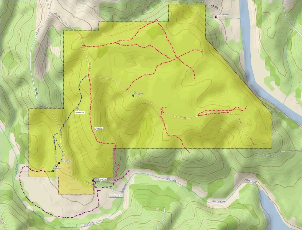
The yellow area indicates the area that is owned by East Wind Community. Not included in this map is an area of 20 acres that we purchased in late 2015 that is directly across the creek (part of it is showing in the southwest quadrant of this map). The areas around Lick Creek and the waterways are leased from the Army Corps of Engineers.


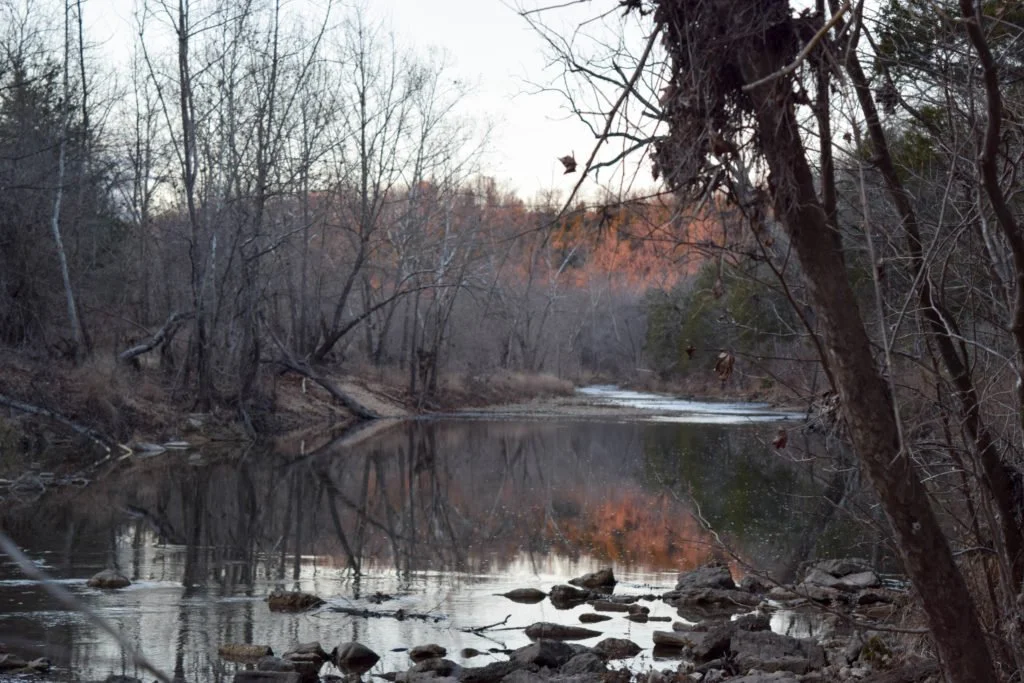


Our 1,200 acres of land has a year round creek with multiple good swimming areas, two caves, cliffs, and numerous trails to explore (We’re still in the process of getting photos of everything, especially through all the seasons).